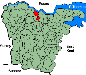
Stone-next-Dartford
OS Grid Reference: TQ5775
The 1841 population was 1,066
The 1841 population was 1,066
Administrative Units
Stone-next-Dartford fell within the Hundred of Axtane. Its 19th century Registration District & Poor Law Union was Dartford.
Probate Jurisdiction was Rochester.
See NWKFHS publications West Kent Sources and School Records for further information.
Census Publications
- 1851 Name Index and Page Images published on CD-Rom as part of CD8 (Dartford Registration District).
- 1851 Name Index (only) published on microfiche as part of Volume V (Dartford Registration District).
- 1891 Transcript published on CD-Rom as part of CD3 (Dartford Registration District).
For ordering details see Census Publications.
Church and Chapels (pre 1910)
Stone-next-Dartford, St Mary the Virgin
Church of England - Ancient Parish Church
Original Registers
These date from 1718.
Transcript published by Rob Cottrell (microfiche Ref. C22). See Thames & Medway Riverside Parish Register Publications.
Images published by NWKFHS (CD-Rom Ref. OR-16). See Parish Register Publications.
Original Registers
These date from 1718.
Transcript published by Rob Cottrell (microfiche Ref. C22). See Thames & Medway Riverside Parish Register Publications.
Images published by NWKFHS (CD-Rom Ref. OR-16). See Parish Register Publications.
St Mary the Virgin - Sep 2007

Church of England cont.
- (No dedication): Mission church, Mile Stone Rd. Built 1878, sold 1968 to Jehovahs Witnesses. No information on registers.
- St Michael: Mission church, Invicta Rd. Built 1883, closed c1933 and sold. No information on registers.
Wesleyan/Methodist
- Methodist: Hill House Rd. (c1890). No information on registers.