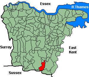
Pembury
OS Grid Reference: TQ6240
The 1841 population was 1,093
The 1841 population was 1,093
Administrative Units
Pembury fell within the Hundred of Washlingstone. Its 19th century Registration District & Poor Law Union was Tonbridge.
Probate Jurisdiction was Rochester to 1845, PCC 1846-57.
See NWKFHS publications West Kent Sources and School Records for further information.
For project purposes this parish covered by Kent FHS.
Church and Chapels (pre 1910)
Pembury, St Peter
Church of England - Ancient Parish Church
Original Registers
These date from 1560.
Original Registers
These date from 1560.
St Peter - Aug 1998

Church of England cont.
- St Peter Upper Church: Hastings Rd. Church built 1846-7. Original registers from 1910.
Baptist
- Baptist: Bopeep. (1834). No information on registers.
Independent/Congregational
- Independent: Bethel, Lower Green. (1835-1885 demolished). No information on registers.
Wesleyan/Methodist
- Wesleyan: (1835) later Hastings Rd (1884-?). No information on registers.