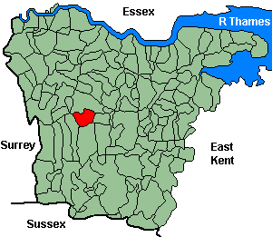
Otford
OS Grid Reference: TQ5159
The 1841 population was 798
The 1841 population was 798
Administrative Units
Otford fell within the Hundred of Codsheath. Its 19th century Registration District & Poor Law Union was Sevenoaks.
Probate Jurisdiction was Shoreham to 1845, PCC 1846-57.
Otford inluded the settlement of Dunton Green (separate civil parish 1909).
See NWKFHS publications West Kent Sources and School Records for further information.
Census Publications
- 1851 Name Index (only) published on microfiche as part of Volume VI (Sevenoaks Registration District).
For ordering details see Census CD-ROMs on the Publication List page.
Church and Chapels (pre 1910)
Otford, St Bartholomew
Church of England - Ancient Parish Church
Original Registers
These date from 1630.
Original Registers
These date from 1630.
St Bartholomew - May 2010

Dunton Green, St John the Divine, London Rd
Church built 1889-90, now converted to commercial premises; parish created 1890 from Otford St Bartholomew.
Original Registers
These date from 1890.
Memorial Inscriptions (1991).
Transcript published by NWKFHS (Microfiche Ref. F8). See MI Publications.
Original Registers
These date from 1890.
Memorial Inscriptions (1991).
Transcript published by NWKFHS (Microfiche Ref. F8). See MI Publications.
St John the Divine - Oct 2006

Independent/Congregational
- Congregational: Dunton Green, London Rd. Built 1873, moved to new church (Station Rd) 1937. No information on registers.
Wesleyan/Methodist
- Wesleyan: Dunton Green. Built 1831. No information on registers.
- Methodist: Old Chapel. (1800). No information on registers.