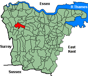
Orpington
OS Grid Reference: TQ4666
The 1841 population was 907
The 1841 population was 907
Administrative Units
Orpington fell within the Hundred of Ruxley. Its 19th century Registration District & Poor Law Union was Bromley.
Probate Jurisdiction was Shoreham to 1845, PCC 1846-57.
See NWKFHS publications West Kent Sources and School Records for further information.
Census Publications
- 1851 Name Index and Page Images published on CD-Rom as part of CD7 (Bromley Registration District).
- 1851 Name Index (only) published on microfiche as part of Volume I (Bromley Registration District).
- 1891 Transcript published on CD-Rom as part of CD2 (Bromley Registration District).
For ordering details see Census CD-ROMs on the Publication List page.
Church and Chapels (pre 1910)
Orpington, All Saints
Church of England - Ancient Parish Church
Original Registers
These date from 1560.
Memorial Inscriptions (1981)
Transcript published by NWKFHS (Microfiche Ref. F2) See MI Publications.
Original Registers
These date from 1560.
Memorial Inscriptions (1981)
Transcript published by NWKFHS (Microfiche Ref. F2) See MI Publications.
All Saints - Jul 2006

Orpington, St Andrew, Lower Rd
Church built 1892-3, parish created 1935 from Orpington All Saints.
Original Registers
These date from 1913.
Original Registers
These date from 1913.
St Andrew - Aug 2006

Church of England cont.
St Paul: Crofton Rd.
Church built 1887 as chapel-of-ease, superseded by new building (1958). No information on registers.
Church built 1887 as chapel-of-ease, superseded by new building (1958). No information on registers.
Roman Catholic
Holy Innocents: Strctland Way. Original registers from 1894.
Parish register transcript published by NWKFHS (Microfiche Ref. F7). See Parish Register Publications.
Parish register transcript published by NWKFHS (Microfiche Ref. F7). See Parish Register Publications.
Baptist
Baptist: Bethesda chapel. Built 1817, moved to Ayncombe Angle 1848, now Tower Rd. No information on registers.