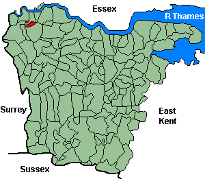
Kidbrooke
OS Grid Reference: TQ4176
The 1841 population was 597
The 1841 population was 597
Administrative Units
Kidbrooke fell within the Hundred of Blackheath. Its 19th century Registration District & Poor Law Union was Lewisham-1868, Woolwich 1868-.
Probate Jurisdiction was Rochester to 1845, PCC 1846-57.
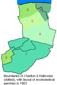
Originally an ancient parish, but later deemed a Liberty; the ecclesiastical parish of Kidbrooke was created in 1867, partly from the liberty and partly from Charlton.
See NWKFHS publications West Kent Sources and School Records for further information.
Census Publications
- 1851 Name Index (only) published on microfiche as part of Volume IV (Lewisham Registration District).
For ordering details see Census CD-ROMs on the Publication List page.
Church and Chapels (pre 1910)
Kidbrooke, St James
Kidbrooke, St James (Map Ref F).
Medieval church long demolished; a new church built 1866-7 and parish refounded 1867.
Original Registers
These date from 1867.
Medieval church long demolished; a new church built 1866-7 and parish refounded 1867.
Original Registers
These date from 1867.
St James - Sep 2008
